Dibër County · North-east

Peshkopi

41.69°N 20.43°E · Last checked: Nov 2026

A green mountain town about 20 km from the border with North Macedonia, below Mount Korab, Albania's highest peak. Known for its sulphur hot springs, its linden-lined main street and the Lura lakes.
From Tirana
About 2.5 h
Best time
Jun–Oct
Good for
Mountains, hot springs, lakes
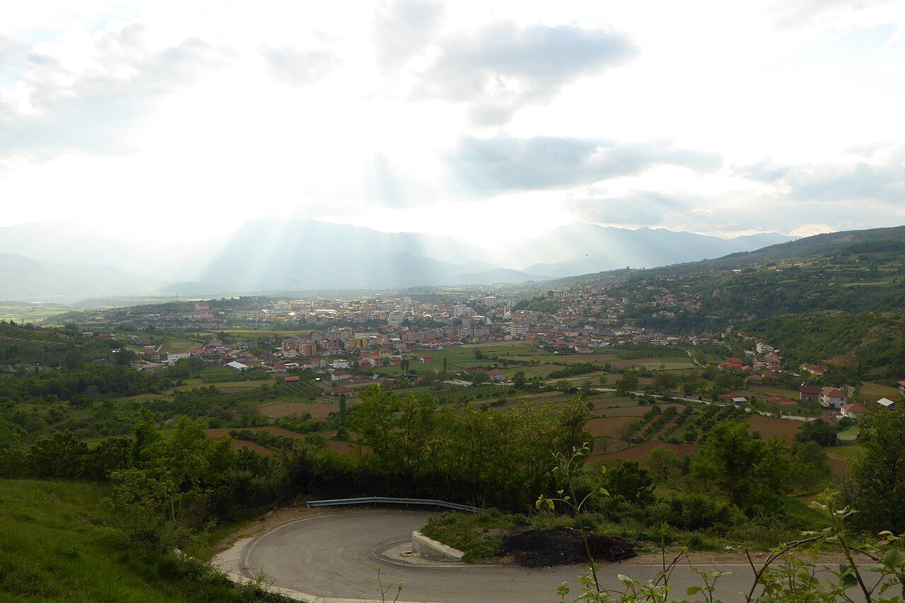
Peshkopi spread across its green valley, seen from the south-west
Photo: Cave2596, CC BY-SA 4.0, via Wikimedia Commons

Places to visit

Hike · full day

Mount Korab

At 2,764 m, the highest point in Albania, on the North Macedonia border. Go with a local guide.

Hot springs · half day

Peshkopi thermal baths

Sulphur springs just east of town, used for baths and treatments.

Nature · full day

Lura Lakes

Glacial lakes in the Lurë-Dejë Mountain National Park, deep in the forest. The road is rough.

Walk · evening

Elez Isufi Boulevard

The pedestrian main street, shaded by linden trees and lined with cafés.

On the map

Zoom with the + and − buttons, two fingers, or Ctrl and the mouse wheel. Open in OpenStreetMap

A short history

  1. The Ottomans build a barracks for up to 8,000 soldiers, and the town grows around it.
  2. Albanian armed bands take the town from the Ottomans.
  3. Bulgarian troops arrive in January 1916 and Austro-Hungarian troops in April. Both leave in September 1918.
  4. The centre of the Dibër region, with a harvest festival every October.

Getting there

  • From Tirana: about 2–2.5 h by car (about 90 km) on the Arbër Road. Buses run about every 40 minutes, from early morning to late afternoon.
  • Most sights in town are close to the centre and walkable.
  • For Korab and the Lura lakes, a 4x4 or a local guide is best.

When to go

BestGoodPeak heat or crowdsQuiet season

Sources

Written in our own words. The facts were checked against these pages in Nov 2026. Prices and timetables change, so confirm them locally before you travel.

Nearby